About
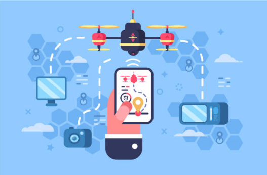
DroneALERT is a global drone incident reporting and intelligence system that contributes to Counter-UAV operations by filling evidence gaps, which occur during drone incident investigations.
- Technology system supporting Counter-UAV's multi-tier solutions by providing comprehensive drone incident reports and management;
- Fast and user-friendly process for the public to report dangerous or potentially illegal drone activities;
- Reporting is optimized for mobile phones, the report can be completed as the indecent is occurring;
- Live, operational system, connected to organizations around the world, who will receive the drone report to aid them during drone incident investigations;
- DroneALERT promotes global drone safety, security, management and mitigation.
Adversarial Testing - Red Team
How does it work?
Red Team takes the role of a threat actor, attacking assets or locations with the objective to break past the defences. As the defender, the Blue Team aims to secure the asset or location against these attacks from the Red Team using their operational procedures and the C-UAS technology deployed.
Why do you need it?
A Red Teaming Operation is used as a critical capacity testing tool to assess the operational procedures, C-UAS Technology capabilities and coordination of security defences over an asset or location. The war-gaming scenarios within the Operation normally identify gaps in operational procedures, personnel training needs, technology weaknesses, and other procedural or technological requirements that would increase an asset or location's defence capabilities.
The DroneALERT Red Team
Our Red Team delivers to client requirements - operating unmanned/manned platforms, kinetic/non-kinetic capabilities, biomimetic and custom platforms in the operational environment and conditions set. We service clients in LEA, Border Protection, Military, VIPs, Events and Public Space protection.
To request a Red Teaming Operation contact
Guardian - Location Protection Assessment
Our Guardian service provides customised on-site threat, risk assessment and CUAS technology recommendations for location protection. Skilled DroneALERT team members will carry out a site inspection identifying location vulnerabilities and threats which contribute towards a report of vulnerabilities, red teaming and training next steps.
To request a Guardian quote contact
Protect - CUAS Capacity classification
Our PROTECT service is divided into two service depending if you are an organisation wishing to procure CUAS Technology or a CUAS Technology Companies
Procuring CUAS Technology
An onsite assessment and client needs will be analysed and a report provided which will detail what type of technology would be suitable for deployment on the organisations site. We do not recommend CUAS companies - only the technology.
CUAS Technology Companies
CUAS Technology companies have the opportunity to have their system 'Red Teamed' by DroneALERT to assess their capacities. By participating in this service, technology companies show transparency to potential new clients as they will be able to provide a DroneALERT PROTECT Report which will detail the testing and system results from detection to data forensics in a final capability level. This service provides technology providers an independent assessment which is much desired by end-users for procurement.
Consultancy
DroneALERT has a long standing reputation and experience in the drone domain, most particularly C-UAS. We provide specialised consultancy services across the entire C-UAS process chain.
To request a consultancy quote contact
Drone Training Academy
The Academy
The DroneALERT Drone Training Academy provides a series of training focusing on Counter Drone, Asset and Location Protection. The courses start from beginner to in-field operations training and are suitable for Governments, Corporations, Law Enforcement or any entity operating in the drone/C-UAS domain.
In-House Training
We come to you to provide valuable training as learning with hands-on training is an effective method of learning. Our team of trainers are globally sourced from police, military and private sectors across the world to give clients the best knowledge base for the training.
Courses
Our list of courses are below. For more information on each course or to book a training, email
Drone Detectives
User Groups
DroneALERT has two main user groups: Organizational Users and Public Users.
Organizational Users
Organizational users are organizations, agencies or authorities such as airports, CAA, police & security agencies, intelligence organizations, utilities, humanitarian aid, insurance agencies, emergency service providers, sporting stadiums, prisons, shopping centers, VIP movement management, hotels etc.
DroneALERT can be deployed anywhere for security and intelligence purposes.
Aid in incident investigation
Organizations use DroneALERT for gathering evidence from the public to aid in a drone incident investigation.
Drone Intelligence Reports
The Drone Intelligence Report from DroneALERLT efficiently consolidates public reports, internal and external data sources and social media into a comprehensive report to fill incident evidence gaps.
Rapid situation assessment
When Drone Intelligence Reports within the DroneALERT system are processed, the relevant organization is notified in near-real time. Accessing report contents gives organizations the edge to make a rapid assessment of the situation to determine the level of security risk and open new avenues of evidence.
Statistics and trends
If a number of reports are processed within an organization's jurisdiction by the public, statistics and trends can be formed which can aid the organization in future drone management planning and mitigation. Global statistics from the system area are also available.
Public users
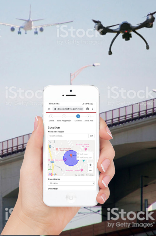
The public simply go to the report incident page to start reporting.
Fast and User friendly
By following the user-friendly reporting process, a series of relevant questions, images and geo-locational information are requested and processed by the system. This information is then constructed into a valuable, evidence-based drone incident report.
All reports from the public must pass a user-verification process before they are added to the system and sent to organizational users.
Helping public and aviation safety
Once the report has been accepted by the system a red pin on the DroneALERT incident map is added, a copy of the report is sent to the public reporter and also to the organization in near-real time. The public role is completed. They are a #DroneDETECTIVE and have contributed to public and aviation safety.
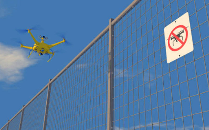
No fly zones and Drone Laws
Want to take your drone to a new location? Fly safe and look at our global no-fly-zones and drone laws before flying.
Drone Detectives
Drone Alert Systems
By joining DroneALERT, Organizations gain access to a comprehensive intelligence system which streamlines data and resources during a drone incident.
- Captures and files valuable drone incident reports from the public;
- Near real-time incident notification;
- Generates comprehensive Drone Intelligence Report;
- Streamlines incident process management flow;
- System customization - linking via API to internal client databases
- Secure and unique client login and dashboard - No IT infrastructure or downloads required
- Social media analysis and management
Incident Management System
DroneALERT is a unique and dynamic system which streamlines incident information capture for organizations. The system is an easy to use and access platform for the public to report information about the incident to aid in evidence building. The reports provided by the public can be viewed by organizations in near real-time, assisting in decision making as an incident occurs. Organizations can access their incidents easily on their dashboard, facilitating information access and flow in and out of the office, during critical moments of an incident.
Report and Incident Dashboard
The client dashboard is designed to take the stress out of a stressful situation, by assisting information and data management during a drone incident. All reports collected by the DroneALERT System are clearly and simply managed by the organization themselves, ensuring control and flexibility. Reports are grouped by incident and the dashboard allows organizations to add custom references, extra documentation and export.
System Customization APIs
DroneALERT is designed to be linked to third party data of clients. Sharing data can aid in decision making, information consolidation, reporting and incident management. APIs can be developed, together with organizations, to gain access to data, such as registrations and flights, drone tracking and identification etc, to add extra critical information to aid during incident investigations. Linked data is added to the DroneALERT incident reports which are sent to organizations to enrich the report and information, benefiting by having relevant incidents consolidated in one report and location.
Social Media Analysis
In current society, posting information on social media is what people like to do. Public posts of social media can be a new and rich source of information and evidence that can aid during incident management and mitigation. DroneALERT focuses on social media analysis of Twitter for gathering supporting information. On the dashboard, clients can select and change their filtering criteria to find information suitable for each incident. This can all be changed on the fly, allowing multiple and continual monitoring, that can lead to new crucial evidence.
Public Awareness Program
At DroneALERT we strongly believe in the importance of awareness campaigns to ensure the public or other entities associated with the organization know how to report to DroneALERT. Together with organizations, we scope, plan and implement a workable, scalable and sustainable awareness program. The benefits of a successful program impact far and wide by keeping the skies safe.
Statistical Incident Reporting
DroneALERT collects incident information which can be crucial for future planning and management. From our data, we can provide statistical reports to organizations following an incident. From 2021, we will be expanding our statistical reporting to include an annual 'Global drone incident analysis, statistics and trends report' available for purchase.
Drone First Responders
Coming soon